Modern life depends on satellite navigation systems. They guide everything from delivery lorries to hiking expeditions. This technology started as a secret American military project in the 1960s.
Now, it’s a key part of global logistics, smartphone apps, and even precision farming. It uses signals from satellites to find locations with amazing accuracy.
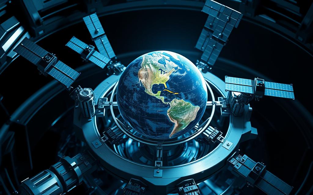
The base is GNSS constellations – networks of satellites from different countries. The US’s GPS is well-known, but Europe’s Galileo and Russia’s GLONASS also play a big role. These systems use space-based triangulation to find distances.
They use ultra-precise atomic clocks for this. Early systems like the TRANSIT programme took hours to find positions. Now, global positioning systems give real-time data with signals from at least four satellites.
This shows how much we rely on satellites for knowing where we are. Understanding this helps us see why satellite navigation fails in places like urban canyons or dense forests. It also explains why devices often use more than one technology to work well.
As we look deeper, you’ll see how atomic timekeeping and the way satellites orbit create the maps on your phone.
Modern positioning systems use a mix of satellites and ground technology. They answer the question “Where am I?” with great accuracy. This is thanks to years of work by both the military and civilians, helping with everything from phone maps to plane safety.
Defining Global Positioning Systems
Core Purpose of Space-Based Navigation
GPS technology gives three-dimensional positioning through atomic clock synchronisation across satellites. It’s different from old compass methods, using timing signals from space. This method works all the time, everywhere, no matter the weather.
Historical Development From TRANSIT to Modern GPS
The first system, TRANSIT (1964), helped with maritime positioning but was not very accurate. Now, with 31 satellites, we get 7m precision. This is thanks to:
Feature
TRANSIT
Modern GPS
Satellites
5-6
31+
Update Frequency
Every 90 minutes
Real-time
Key Technology
Radio Doppler
Atomic clocks
Essential Components Overview
Space Segment: Satellite Constellations
At least 24 satellites orbit 20,200km above Earth, each with four atomic clocks. Their paths mean six satellites are always in view from any spot.
Control Segment: Ground Monitoring Stations
A global network of ground control networks keeps satellites in check. These stations update data daily and watch over signal quality.
User Segment: Receiver Devices
From phones to planes, receivers use receiver algorithms to decode signals. The best ones can even correct for delays in the air, giving accuracy down to a few centimetres.
GPS Satellite Infrastructure
The heart of global positioning is its satellite network and transmission systems. This setup combines orbital engineering with advanced signal technology. It offers metre-level accuracy all over the world.
Orbital Mechanics and Configuration
GPS satellites are in Medium Earth Orbit (MEO) at 20,180km high. This MEO configuration ensures good coverage and signal strength. It lets four satellites be seen from any point on Earth 24/7.
The constellation spans six orbital planes at 55 degrees. Each plane has four active satellites, creating zones of overlap. This setup means at least eight satellites are always in view globally, making positioning reliable.
Medium Earth Orbit Specifics
12-hour orbital period
20,180km optimal altitude for signal reach
55-degree inclination for polar coverage
Signal Transmission Technology
Modern GPS uses L-band signal propagation with two main frequencies:
Frequency
Use Case
Accuracy
L1 (1575.42 MHz)
Civilian navigation
3-5 metres
L2 (1227.6 MHz)
Military applications
Sub-metre
Rubidium and caesium atomic clocks keep time with nanosecond precision. These clocks are key to GPS accuracy, making up 98% of it by synchronising signals over 12,000 miles.
Satellite Generations
The Block IIIA enhancements have changed civilian GPS use:
Feature
Block IIF
Block IIIA
L5 Frequency
No
Yes
Signal Strength
1x
8x
Accuracy
3m
1m
The new L5 frequency (1176 MHz) helps with navigation in cities by going through buildings better. Current Block IIIA satellites last eight times longer than those from the 1990s, ensuring top service quality.
Understanding How GPS Technology Works
GPS technology uses a mix of physics and engineering to give us our exact location. It works by using four-dimensional coordinates – three for space and one for time. This needs accuracy down to nanoseconds.
The Science of Four-Dimensional Positioning
Calculating Latitude, Longitude and Altitude
GPS finds your location by measuring how far you are from four satellites. Each satellite sends out its location and when it sent the signal. This lets your device figure out:
Horizontal coordinates (latitude/longitude)
Vertical elevation (altitude)
Time offset from atomic clocks
This method also takes into account Earth’s shape and how signals are slowed by the air.
Time Synchronisation Criticality
Atomic clocks on satellites lose 38 microseconds every day. This is because of how fast they’re moving and the gravity they’re under. If we didn’t adjust for this, our location would be off by 10km every day. Luckily, GPS systems use Einstein’s field equations to keep their clocks in sync.
Decoding Satellite Signals
Pseudorandom Code Structure
Each GPS satellite sends out a unique 1,023-bit pseudorandom code every millisecond. Your device makes the same code and measures how long it takes for the signal to come back. This lets it figure out how far away the satellite is, with an error of just 5-10 metres.
Navigation Message Components
The data stream is sent at 50 bits per second. It includes:
Ephemeris data (precise orbital parameters)
Satellite health status
Time correction parameters
Almanac data for other satellites
This info updates every 30 seconds to keep your location accurate.
The Trilateration Process Explained
At the heart of GPS is a complex method called trilateration. It uses satellite signals and maths to find locations on Earth.
Geometric Positioning Principles
Trilateration maths calculates distances to satellites. Each satellite is the centre of a sphere. Three spheres meet at two points, but only one is on Earth.
Sphere Intersection Mathematics
The system solves equations with satellite data and signal times. But, four satellites are needed for accurate 3D location.
Minimum Four Satellites Requirement
Three satellites give 2D coordinates. The fourth satellite is key for:
Measuring altitude
Fixing receiver clock errors
Error Correction Mechanisms
Modern GPS uses advanced methods to fix signal issues. Ground systems have improved accuracy, vital for aviation.
Differential GPS (DGPS) Implementation
DGPS uses fixed stations to correct signals. These corrections help receivers, cutting errors to under 10 centimetres. The system’s success depends on station distances.
WAAS/EGNOS Augmentation Systems
WAAS (US) and EGNOS (Europe) improve GPS with satellite corrections:
Feature
DGPS
WAAS/EGNOS
Coverage Area
Local (≤100 km)
Continental
Correction Source
Ground stations
Geostationary satellites
Accuracy Improvement
85-90%
95-98%
These systems use data from many stations. They create models that boost GPS for flying and farming.
Factors Impacting Positioning Accuracy
Satellite navigation systems are very precise. But, real-world conditions can cause errors. These errors can make your device show 3-metre or 30-metre accuracy.
Atmospheric Interference
Satellite signals travel 20,000 km through Earth’s atmosphere. But, they face resistance. Two layers of the atmosphere make positioning less accurate.
Ionospheric Delay Challenges
The ionosphere’s charged particles slow GPS signals by 5-15 metres. The impact varies with:
Time of day (greatest at night)
Solar activity levels
Satellite elevation angle
Tropospheric Effects on Signal Speed
Humidity and temperature in the lower atmosphere add 2-25 metres of error. These effects:
Can’t be corrected using dual-frequency signals
Require local weather data for compensation
Environmental Obstructions
Urban and natural landscapes cause signal reliability issues. They do this through two main ways.
Urban Canyon Multipath Errors
Reflections between buildings cause ghost signals. These signals trick receivers into calculating false positions. Modern systems fight this with:
Mitigation Technique
Error Reduction
Power Requirement
Signal polarisation filtering
40-60%
Low
3D mapping correlation
70-85%
High
Foliage Attenuation Measurements
Leaf moisture content and canopy density affect signal loss:
Deciduous forests: 8-12 dB attenuation
Coniferous forests: 15-20 dB attenuation
Agricultural crops: 3-6 dB attenuation
Satellite Geometry Considerations
The way satellites are arranged affects accuracy. This is through DOP optimisation principles:
Dilution of Precision Factors
DOP values show how good the geometry is:
DOP Rating
Positional Accuracy
Typical Scenario
1-2 (Excellent)
< 2m
Open sky
4-6 (Moderate)
5-10m
Suburban areas
Optimal Constellation Configurations
Modern receivers use multi-constellation support. They get better satellite geometry by:
Combining GPS with Galileo/GLONASS satellites
Maintaining 8-12 visible satellites
Prioritising satellites above 15° elevation
Practical Applications of GPS Technology
GPS systems have grown beyond just tracking locations. They are now key in many fields. From helping driverless cars to changing farming, GPS has made amazing things possible in the last 20 years.
Transportation Navigation Systems
Automotive route guidance has changed a lot with autonomous vehicle navigation. Today, GPS uses real-time traffic and precise positioning. This cuts down on traffic and fuel use by up to 15%, studies show.
In flying, waypoint navigation is like old-school star navigation. Pilots use GPS to follow virtual beacons in the sky. This helps planes fly accurately, even when it’s very dark.
Precision Agriculture Uses
Farming has also seen big changes with GPS. It helps with automated tractor guidance. Farmers can now:
Plant crops with 2cm accuracy
Apply fertilisers selectively
Work machines 24/7 during key seasons
Crop yield monitoring uses GPS and soil sensors. This makes detailed maps of harvests. An agronomist said:
“Precision agriculture has made our farm 40% more efficient and cut chemical use by a third.”
Scientific Research Applications
Geologists use geodetic surveying to study plate tectonics monitoring. GPS helps track how continents move with great accuracy. This data is key for predicting earthquakes.
In studying the atmosphere, GPS helps profile:
Tropospheric water vapour levels
Ionospheric electron density
Global temperature patterns
Application
Key Technology
Accuracy Level
Autonomous Farming
RTK Positioning
±2 cm
Tectonic Monitoring
GNSS Networks
±1 mm/year
Aviation Navigation
SBAS Augmentation
±1.5 m
Modern Advancements in GPS Systems
Today’s navigation systems have seen big changes to meet different needs. Two key areas stand out: multi-constellation GNSS networks and better signal processing. These steps have overcome old limits, bringing us closer to centimetre-level accuracy in many fields.
Multi-Constellation Support
GLONASS/Galileo integration: Combines Russian and European satellites to improve urban canyon coverage by 40%
BeiDou compatibility: China’s 35-satellite system enhances Asia-Pacific positioning reliability
This multi-constellation approach makes us less reliant on one system. It’s very useful during times of political tension or technical issues.
Enhanced Signal Processing
New algorithms are tackling long-standing accuracy problems:
Multi-path mitigation techniques
Advanced filters cut down on signal reflections from buildings. They use machine learning to spot real satellite signals from fake ones.
Carrier-phase tracking improvements
Military-grade anti-jamming systems are now helping civilian carrier-phase tracking. This means sub-10cm accuracy for things like surveying and self-driving cars. The new M-code encryption also boosts security for defence uses.
These updates have made our positioning systems stronger. They’re ready to support new tech like drone delivery and smart city navigation.
Conclusion
GPS technology has come a long way from its Cold War origins. It’s now a key part of our daily lives, guiding everything from our phones to emergency services. This technology quietly changes how we see space and time.
Recently, new advancements in GPS have tackled old problems like jamming and spoofing. Companies like Garmin and Trimble have created systems that use multiple satellite systems at once. This makes GPS more reliable, helping everyone from hikers to sailors.
The future of GPS looks even more promising. It will use quantum clocks and AI to improve accuracy. Even in busy cities, new systems will offer precise location information. GPS will help solve big problems today and prepare us for tomorrow’s challenges.
FAQ
What are the three essential components enabling GPS functionality?
GPS needs 31+ satellites, monitoring stations around the world, and receivers on the ground. Satellites send signals, stations keep track of orbits, and receivers figure out where you are using time from at least four satellites.
How did atomic clocks transform GPS accuracy from early TRANSIT systems?
Old TRANSIT systems were only accurate to a few kilometres. But atomic clocks made GPS accurate to a few centimetres. This is because they can measure time to nanoseconds, which is key for precise distance calculations at 20,180km high.
Why do Block IIIA satellites significantly improve civilian positioning?
Block IIIA satellites send out L5 frequency signals. These signals go through buildings and trees better than old signals. This means better accuracy in cities and for farming, down to sub-10cm.
How does atmospheric interference degrade GPS accuracy?
Signals slow down in the air due to moisture and charged particles. Dual-frequency receivers fix this, and WAAS helps with planes by correcting errors from the ground.
Why must receivers decode signals from four satellites?
Three satellites give you 2D location, but you need a fourth for time. This is because small timing errors can cause big location mistakes, as shown by Source 3.
How do modern tractors use GPS for precision farming?
Tractors use GPS to plant rows with 2cm accuracy. This is like ancient navigation but uses satellites for better farming.
What advantages does combining GPS with Galileo offer?
Using both GPS and Galileo increases signal strength in cities by 40%. Military tech gets better with M-code encryption, and scientists can measure the Earth’s plates with millimetre accuracy.
How do modern receivers mitigate foliage signal obstruction?
New algorithms pick the best signal paths, even through forests. This reduces errors to under 1m, thanks to L5’s ability to penetrate better.
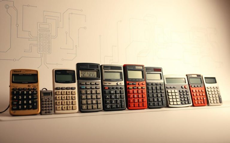
Before silicon chips and touchscreens, people used beads and rods for math. The abacus, dating back to 2500 BC, was the first tool for numbers. It started a journey in computing technology history. In the 17th century, machines like Blaise Pascal’s Pascaline changed math. These inventions moved math from manual to mechanical. The Industrial Revolution…
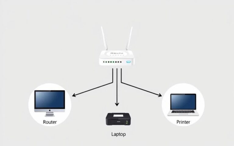
Accessing a computer on your home network makes sharing files easy. It’s key for working on projects together. This guide shows you how to start sharing over your network. It’ll let you get to shared folders and printers easily. More devices than ever connect to the internet now. It’s crucial to know how to get…
Thinking of starting a career in computer science? It’s a great choice in our tech-heavy world. The need for computer scientists is booming. There are more than 50,000 computer scientist job ads on LinkedIn. To enter this exciting industry, you must have the right computer science qualifications and skills. The U.S. Bureau of Labor Statistics…
The OSI model includes the transport layer as its fourth level. It’s also the second layer in the TCP/IP model. This layer makes sure data flows well between sender and receiver. It handles the delivery of data packets across various networks. It uses special networking protocols like TCP and UDP. These protocols help send data…
Six centuries ago, scholars gathered in dimly lit halls. They listened to lectures copied from handwritten manuscripts. Today, learners worldwide access interactive courses on devices that fit in their palms. This shows how the digital education transformation has changed how we learn. The move from old teaching methods to tech-driven learning platforms has changed a…
Imagine a world where the Roman Empire still exists. It’s an interesting thought, right? This idea makes us think about how technology would have grown from the empire’s achievements. The Romans were known for their impressive buildings, well-planned cities, and many other advances. Their economy supported a growing population and higher incomes per person. This…